

The U.S. Bureau of Reclamation released a sweeping federal proposal on Friday aimed at mitigating a catastrophic water shortage in the Colorado River Basin, a move that would require the Lower Basin states of Arizona, California, and Nevada to significantly curtail their water consumption. The proposal, which serves as a roadmap for managing the beleaguered waterway through 2036, seeks to stabilize a system that provides essential water and electricity to more than 40 million people across the American West. By mandating cuts of up to 3 million acre-feet annually, the federal government is attempting to reconcile a century-old water-sharing agreement with the harsh realities of a modern climate characterized by prolonged drought and rising temperatures.
Under the framework of the proposal, the four Upper Basin states—Colorado, New Mexico, Utah, and Wyoming—are currently spared from mandatory reductions. This distinction highlights the ongoing geopolitical friction between the two halves of the basin. The Bureau’s plan is designed to be inherently flexible, allowing for deeper cuts during exceptionally dry periods while providing states with a window of time to reach a more permanent, collective agreement. The urgency of the situation is underscored by the impending expiration of several key laws and guidelines governing the river at the end of 2026, creating a high-stakes environment for federal and state negotiators.
The Mechanics of the Federal Proposal
The heart of the Bureau of Reclamation’s proposal lies in a tiered reduction system for the Lower Basin. Arizona, California, and Nevada could be forced to collectively reduce their usage by as much as 3 million acre-feet per year. To put this figure into perspective, 3 million acre-feet represents approximately 130 billion cubic feet of water, roughly the total combined annual allocation for Arizona and Nevada. Such a reduction is estimated to be enough water to serve the needs of more than 25 million people annually.
The specific volume of these cuts would not be static; instead, they would be re-evaluated every two years based on the hydrological conditions of the basin. This data-driven approach is intended to prevent the reservoirs from reaching "dead pool" levels, where water would no longer flow through the dams to generate hydropower or provide downstream deliveries. Interior Secretary Doug Burgum emphasized the gravity of the federal intervention, stating that the Department has a fundamental responsibility to ensure the Colorado River remains a reliable resource for the communities and industries that have built the Western economy.
The proposal suggests that the first 1.5 million acre-feet of cuts would be divided among the three states based on a plan they previously developed. However, if conditions worsen and deeper cuts are required, the federal government would pivot to the established "Law of the River," which includes a rigid system of priority water rights. This system historically favors California’s senior water rights, often placing the heaviest burden of conservation on Arizona and Nevada.
A Century of Over-Allocation: The Historical Context
To understand the current crisis, one must look back to the Colorado River Compact of 1922. At the time, representatives from the seven basin states gathered to divide the river’s flows based on what is now recognized as an era of abnormally high precipitation. The 1922 agreement was predicated on the assumption that the river could reliably provide 15 million acre-feet of water annually. History and modern science have proven this assumption false.
For the past several decades, the river has been consistently over-allocated. This structural deficit has been exacerbated by a "megadrought" that began in the early 2000s, which scientists have identified as the driest period in the region in over 1,200 years. As temperatures rise due to climate change, more precipitation falls as rain rather than snow, and what snow does fall is often absorbed by parched soils or evaporated before it can reach the river’s tributaries. Consequently, the 1,450-mile waterway, which flows from the Rocky Mountains to the Gulf of California, no longer reaches the sea, ending instead in a dry delta in Mexico.
The health of the system is traditionally measured by the elevations of Lake Mead and Lake Powell, the two largest man-made reservoirs in the United States. Recent data indicates that these reservoirs are currently at their lowest combined levels since they were first filled. A record-dry winter has further depleted these reserves, pushing the system toward a tipping point where hydropower generation at the Hoover and Glen Canyon Dams could become impossible.
Chronology of the Modern Water Crisis
The path to the current federal proposal has been marked by a series of stopgap measures and increasingly tense negotiations:

- 2007: The states agreed to "Interim Guidelines" to manage the reservoirs during shortages, but these did not account for the severity of the ongoing drought.
- 2019: The Drought Contingency Plan (DCP) was signed, requiring voluntary cuts from Lower Basin states as Lake Mead’s levels dropped.
- 2021: The federal government declared the first-ever official water shortage on the Colorado River, triggering mandatory cuts for Arizona, Nevada, and Mexico.
- 2023-2024: Negotiations for post-2026 guidelines reached a stalemate as states failed to agree on a unified plan, leading to the federal government’s decision to draft its own proposal.
- June 2026: Record-low reservoir levels and the fast-approaching expiration of existing agreements forced the Bureau of Reclamation to release the current proposal to prevent a systemic collapse.
Divergent Reactions from Basin States
The federal proposal has been met with a spectrum of reactions ranging from reluctant acceptance to outright hostility. In Arizona, where water managers have long complained about the state’s junior priority status, officials were quick to criticize the plan. The Arizona Department of Water Resources characterized the proposed cuts as devastating to the state’s economy and its agricultural sector. The Central Arizona Project (CAP), which operates the massive canal system delivering water to Phoenix and Tucson, argued that the proposal fails to accurately respect Arizona’s legal rights and contributions to previous conservation efforts.
Nevada officials echoed these concerns, describing the magnitude of the proposed reductions as unrealistic. Given that Nevada already operates one of the most aggressive water conservation programs in the country, state leaders expressed frustration at being asked to find even deeper savings.
In contrast, California officials took a more measured tone, viewing the proposal as a necessary milestone in a long process. Because California holds senior water rights, it is generally more insulated from the most severe cuts under the existing legal framework, though the state’s agricultural hubs in the Imperial Valley remain deeply concerned about the long-term reliability of their supply.
The Upper Basin states—Colorado, New Mexico, Utah, and Wyoming—expressed a degree of relief that they were not subjected to mandatory federal cuts. In a joint statement, the governors of these four states praised the proposal for reflecting the reality of the available water supply. They maintained that mandatory cuts in the Upper Basin would violate the 1922 Compact, though they indicated a willingness to continue with voluntary conservation programs, particularly among agricultural users.
Economic and Agricultural Implications
The economic ripples of a 3-million-acre-foot reduction would be felt far beyond the banks of the Colorado River. The agricultural regions of Southern California and Yuma, Arizona, are often referred to as the "winter salad bowl" of North America. These areas produce the vast majority of the continent’s leafy greens, such as lettuce and spinach, during the winter months.
If farmers are forced to leave fields unplanted—a practice known as fallowing—the result could be higher grocery prices for consumers and a significant blow to the rural economies of the Southwest. Furthermore, the reliance on the river for alfalfa and other forage crops, which support the dairy and beef industries, means that the impacts would cascade through the food supply chain.
Urban centers are also facing a period of profound transition. While major metropolitan areas like Phoenix and Las Vegas have diversified their water portfolios, they are not immune to the rising costs of water management. Rhett Larson, a water law professor at Arizona State University, noted that the region is not necessarily "running out of water," but it is certainly "running out of cheap water." In Gilbert, Arizona, residential water rates have already surged by 50% since early 2025, a trend that is expected to continue as cities invest in more expensive alternatives.
The Shift Toward Alternative Water Sources
As the Colorado River’s reliability falters, states and municipalities are aggressively pursuing "new" water through technological and conservation-based initiatives. These include:
- Wastewater Recycling: Direct and indirect potable reuse projects are being accelerated. By treating wastewater to drinking-water standards, cities can create a "closed-loop" system that reduces their dependence on river withdrawals.
- Desalination: While energy-intensive and expensive, desalination of brackish groundwater or seawater (in partnership with Mexico) is being studied as a long-term solution for coastal and inland regions alike.
- Groundwater Management: With surface water becoming scarce, there is increased pressure on aquifers. However, many states are implementing stricter regulations to prevent the over-pumping of groundwater, which can lead to land subsidence and permanent loss of storage capacity.
- Invasive Species Control: Removing water-intensive invasive plants like salt cedar from the river’s banks is being used as a method to keep more water in the main channel.
Conclusion and Next Steps
The U.S. Bureau of Reclamation is expected to finalize this proposal in the coming days, following a brief period for final comments from the affected states. While the federal plan provides a much-needed framework for the next decade, it is widely viewed as a bridge rather than a final destination. The ultimate goal remains a consensus-based agreement among all seven states that can withstand the legal challenges and hydrological uncertainties of the 21st century.
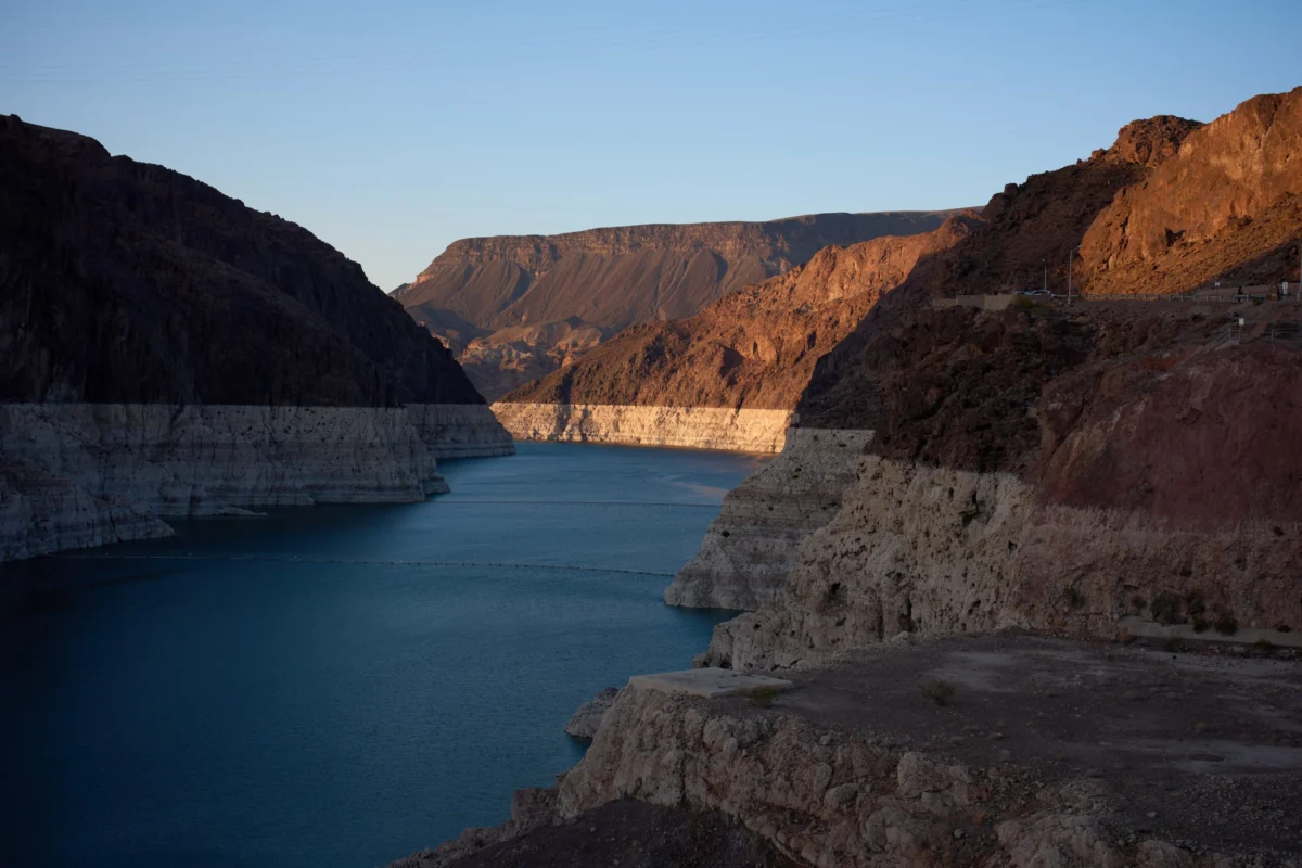
As the "bathtub rings" of white minerals continue to grow around Lake Mead, the visual evidence of the crisis remains a stark reminder of the stakes. The Colorado River is no longer the predictable resource it was once thought to be; it is a system in transition, demanding a fundamental shift in how the American West lives, grows, and sustains itself in an era of scarcity.
