

Portland General Electric (PGE) has officially launched a pioneering wildfire research initiative designed to measure the moisture levels of live vegetation, marking a significant evolution in how utilities assess and mitigate fire risks in the Pacific Northwest. This "first of its kind" program seeks to fill a critical data gap by monitoring how living plants—rather than just dead debris—respond to environmental stressors such as prolonged heatwaves and drought. By integrating this biological data with advanced satellite imagery and artificial intelligence, the utility aims to create a more precise, real-time map of wildfire vulnerability across its expansive service territory.
The initiative is being conducted in close coordination with NASA’s FireSense program and researchers from the University of Idaho. This partnership reflects a growing trend among utility providers to move beyond traditional meteorology, embracing ecological science to safeguard the electrical grid and the communities it serves. As climate patterns in the Pacific Northwest continue to shift toward hotter, drier summers, the ability to predict how "live fuels" will behave has become a cornerstone of PGE’s long-term resilience strategy.
The Science of Live Fuel Moisture: Bridging the Data Gap
For decades, wildfire professionals have relied on "dead fuel moisture" readings—the moisture content of fallen leaves, dry grass, and downed branches—to gauge fire risk. While these metrics remain essential, they do not account for the complex physiological responses of living trees and shrubs. Live vegetation acts as a thermal buffer; as long as plants retain sufficient internal moisture, they are harder to ignite and can even slow the spread of a fire. However, once live fuel moisture drops below a certain threshold, these plants can become highly volatile, contributing to more intense and fast-moving "crown fires."
PGE’s lead meteorologist, Lisa Kriederman, noted that the Pacific Northwest has historically lacked a comprehensive record of these biological measurements. "We are doing this to understand climatologically what we are normally supposed to be seeing in the vegetation throughout the season," Kriederman explained. By establishing a baseline of "normal" seasonal drying, the utility can more accurately identify when vegetation has reached "unusually dry or stressed" conditions that necessitate emergency interventions.
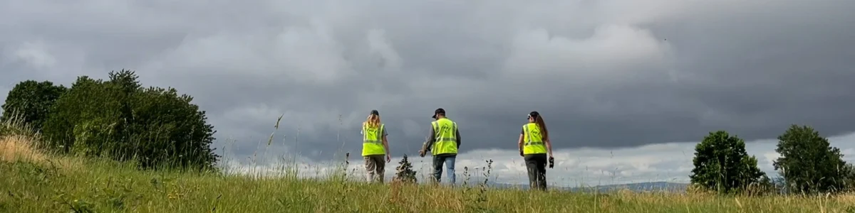
The research involves significant manual fieldwork. PGE is currently sampling live vegetation at 11 strategic locations where weather stations and soil moisture sensors are already operational. Researchers track the full annual cycle: the "green-up" of spring, the peak moisture of early summer, the steady drying of the late season, and the eventual recovery following autumn precipitation. This localized data is then cross-referenced with regional weather patterns to build a predictive model tailored to the specific microclimates of Oregon.
A Collaborative Framework: NASA FireSense and Academic Expertise
The inclusion of NASA’s FireSense program brings a global perspective to PGE’s local efforts. FireSense is a NASA-led initiative aimed at providing high-quality Earth science data to operational agencies to improve wildfire management. By leveraging NASA’s satellite capabilities, PGE can scale its ground-level observations, using remote sensing to estimate vegetation health across thousands of acres that are inaccessible to manual sampling teams.
The University of Idaho provides the academic rigor necessary to interpret this data. Researchers are focusing on how different species of vegetation—ranging from the dense Douglas fir forests of the Cascades to the shrub-lands of the high desert—respond to soil moisture depletion. This multi-layered approach allows PGE to move from broad regional warnings to site-specific risk assessments. The goal is to provide this "missing historical record" to public partners, including state forestry departments and emergency responders, ensuring that the entire region benefits from the utility’s investment in primary research.
Technological Integration: AI Cameras and IoT Sensors
The live vegetation study is the latest addition to an increasingly sophisticated "wildfire toolbox" maintained by PGE. Central to this suite is a partnership with Pano AI, a company specializing in deep-learning computer vision. Pano AI utilizes high-resolution cameras mounted on existing utility infrastructure to scan the horizon for signs of smoke.
The Pano AI system operates on a four-pillar model:

- High-Resolution Hardware: Cameras capable of 360-degree rotation and extreme zoom.
- AI Detection: Algorithms trained to distinguish between smoke, dust clouds, and fog.
- Human Verification: 24/7 analysts who vet AI alerts to eliminate false positives.
- Triangulation: A platform that uses multiple camera feeds to pinpoint the exact latitude and longitude of a fire.
Arvind Satyam, COO and co-founder of Pano AI, emphasized that while cameras are powerful, they are most effective when complemented by other data streams. When a camera’s line of sight is blocked by terrain or heavy canopy, the system integrates infrared satellite feeds. These satellites can detect heat signatures that the human eye (or a standard camera) cannot see. Once a heat signature is flagged, the system automatically pivots nearby ground cameras to confirm the ignition.
In addition to visual detection, PGE utilizes Internet of Things (IoT) sensors from IND Technology. These sensors monitor the electrical grid for "early faults"—microscopic fluctuations in the flow of electricity that often precede a physical failure. By identifying a fraying wire or a failing transformer before it sparks, PGE can dispatch crews to make repairs during "blue sky" conditions, preventing a potential disaster before it begins. These sensors are particularly valuable because they are cost-effective and can be installed without disrupting power to customers.
Defining the High-Risk Fire Zone (HRFZ)
PGE’s strategy is heavily dictated by its High-Risk Fire Zones (HRFZs), geographic areas where the combination of dense vegetation, steep terrain, and frequent high winds creates a "perfect storm" for wildfire. These zones are not static; they are updated annually based on the latest climate data and the progress of system hardening projects.
Currently, PGE reports that approximately 2% of its customer base resides within an HRFZ. However, the infrastructure risk is more pronounced, with 9% of the utility’s overhead power lines passing through these high-danger corridors. To manage this, PGE has achieved 100% camera and weather station coverage within these zones, ensuring that no ignition goes undetected for more than a few minutes.
Strategic Hierarchy: From Hardening to Public Safety Power Shutoffs
PGE categorizes its wildfire mitigation efforts into three distinct timeframes:
- Long-Term (System Hardening): This involves physical upgrades to the grid, such as replacing wooden poles with steel ones, installing "covered conductors" (insulated wires that won’t spark if a branch hits them), and undergrounding power lines in the most vulnerable areas.
- Short-Term (Situational Awareness): This is where the live vegetation research and AI cameras play a role. By understanding the current state of the "fuel" and the weather, PGE can adjust the sensitivity of its circuit breakers—a process known as "enhanced safety settings"—which causes power to trip off instantly if a fault is detected.
- Immediate-Term (Public Safety Power Shutoffs): Known as PSPS, this is the utility’s "measure of last resort." When weather conditions reach extreme thresholds (low humidity, high winds, and critically dry vegetation), PGE may preemptively de-energize lines to prevent any possibility of a utility-caused ignition. To date, about 4% of PGE customers have experienced at least one PSPS event.
The live vegetation data is expected to refine the PSPS process. By knowing exactly how dry the plants are, PGE can make more informed decisions about whether a shutoff is truly necessary, potentially reducing the frequency and duration of outages for customers.
Broader Implications for Grid Resilience and Public Safety
The shift toward data-driven wildfire mitigation has profound implications for the utility industry and the public. For PGE, this research is a proactive response to the increasing liability and insurance costs associated with wildfires in the Western United States. Following the devastating 2020 fire season, which saw millions of acres burn across Oregon and Washington, utilities have been under intense pressure from regulators and the public to prove they are taking every available step to prevent ignitions.
Furthermore, the data collected through this program will likely influence future building codes, insurance premiums, and urban planning. If certain species of vegetation are found to be significantly more resilient to drought, homeowners and municipalities may be encouraged to prioritize those plants in "defensible space" landscaping.
As PGE continues to collect data through the 2024 and 2025 seasons, the utility plans to share its findings with the broader scientific community. The integration of NASA’s satellite expertise with boots-on-the-ground biological sampling represents a new frontier in climate adaptation. For the residents of Portland and the surrounding regions, it means a power grid that is not only smarter and more responsive but also more deeply attuned to the natural environment in which it operates.
In an era where "normal" weather is a thing of the past, PGE’s investment in the "dankness" of the local flora may well be the key to keeping the lights on—and the forests standing—in an increasingly volatile climate.
